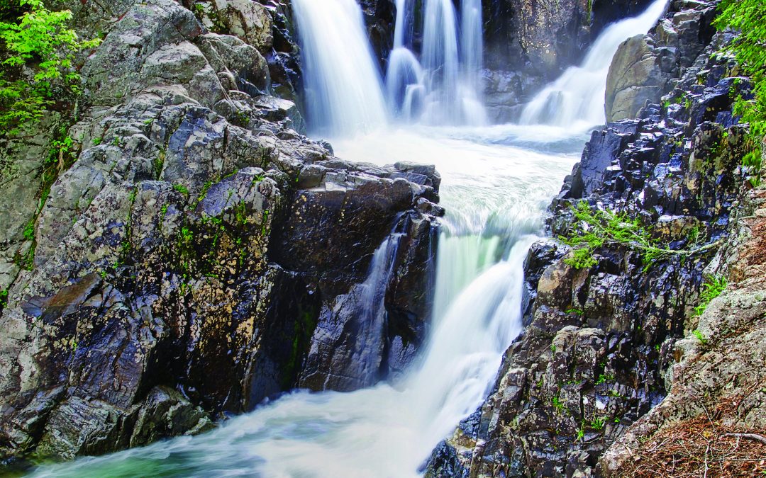
photograph from Goodnow Mountain by Nancie Battaglia
Five hikes under five miles
I have never been a long-distance hiker. Planning and commitment are needed to tackle the big peaks, and if I’m honest I have never shown a particular aptitude in either of these areas. I was always more of a, “Hey, it’s a nice day. Let’s go play in the woods!” kind of person. This trait doesn’t really work for hikes requiring significant preparation, but it is well suited for the shorter trails scattered throughout the Adirondacks. These hikes enable me to experience the tranquility and beauty of the area, but at distances that are more appealing.
For many of us, one of the most challenging aspects of life right now is making connections. Connections with family and friends. Strangers. Nature. Hiking with other people of all abilities on shorter hikes can help foster these connections. It can take us away from distractions, letting us focus on each other and our surroundings. I have friends I still laugh with about the time I split open my pants while scooting down a rock face, and my child and I remain incredulous about a porcupine that sauntered between us on a trail years ago. Then again, hiking alone and connecting with the natural world makes me breathe better, even if I’m panting in the moment. It gets me out of my head and gives me peace. While I wouldn’t feel comfortable taking a Grand Excursion by myself, I’m comfortable with—and relish—a shorter solo hike.
The shorter-distance hikes are gentler on all types of bodies. My knees, in particular, dictate the length of a hike depending on the day. I’m more inclined to step out of my door if I know a hike will get my lungs and muscles working, but won’t be so intense I can’t move the next day. Hikers at the beginner level looking to develop skills (and muscles) can get started with low-distance hikes. Some folks choose short trails after they’ve bagged the bigger peaks and can’t—or don’t want to—continue with the longer distances. They want to be in the woods and know these trails offer just as much as their grand counterparts. I hear there are even people who use short hikes as “warm-ups” for extended hikes they are tackling the following day. These must be the planning people.
After I had kids, I hiked more frequently. And yes, I was forced to prepare more than I may have liked. When my children were younger, hikes with low mileage and big rewards were the most successful. These rewards often involved impressive summits, water for post-hike play, interesting features, or (perhaps too frequently) ice cream from the local stands. As my kids grow, assurances of short hikes can lead to less grumbling if they are hesitant to leave their books and phones. When peers are invited to join us on the trail, they enjoy “face time” without technology. Hiking with my kids provides shared experiences and opportunities to discuss important topics and nothing in particular. Toss in a game of “the ground is lava!” and there’s nothing better for family bonding.
The following are hikes I love to explore alone, with family and friends, or both. They all clock in under five miles round-trip and vary in grade. (For shorter excursions, I generally stick closer to my northeastern-quadrant home, so my picks are scattered throughout this area.) A shorter hike isn’t as drastic a victim of overuse as those leading to the highest peaks. Spreading the love to all the park’s trails is a helpful land management tool.
Goodnow Mountain, Newcomb
Goodnow was the first mountain I hiked when I came to the Adirondacks almost 20 years ago. I was camping in Newcomb with my boyfriend, and it was the perfect trail to introduce him to the mountains I already loved. The adventure made an impression. We ended up moving here a couple of years later.
Goodnow Mountain is private land owned and maintained by the SUNY College of Environmental Science and Forestry (ESF). They do an amazing job with trail maintenance: constructing foot-bridges, creating rock paths and taking care of trail hazards. The school even hosts a Goodnow webcam. The trail features natural and manmade sights that keep things interesting, and has a good balance of steep and catch-your-breath sections, the last of which I particularly appreciate. The tree hugging a rock is charming, and the observer’s cabin at the summit is always a point of interest. There is a 60-foot fire tower. From the first landing of its stairs is The View. Providing 360-degree vistas, you can see most of the High Peaks, as well as a few of the surrounding lakes.
If You Go
Round-trip: 3.8 miles
Elevation gain: 1,040 feet
Summit elevation: 2,664 feet
Directions: From the intersection of Routes 28N and 30 in the town of Long Lake, follow Route 28N toward Newcomb. After about 12 miles, the trailhead is marked with a large white ESF sign on the right.
Coon Mountain, Westport
My need for a nice summit has historically made me scoff at the quote, “Life is a journey, not a destination.” I admit I sometimes might neglect a trail as I make my way to its peak, but I’ll spend more time considering it on the way down. This is never the case with Coon Mountain: I cannot ignore the trail’s topography, nor the nature that thrives within it.
Coon Mountain is part of Champlain Area Trails (CATS) and is owned by the Adirondack Land Trust. The summit is beautiful. There is plenty of space to explore while raptors coast at eye level. The open vista is generous, with its view of Lake Champlain, as well as the surrounding mountains of both the Adirondacks and Vermont. But there is a reason the CATS website provides a “Species Checklist” for the Coon Mountain trail. I love to meander through the impressive ravine and pick my way up the rock scrambles, encountering a diversity of trees, ferns, wildflowers, fungi, mosses and lichen. Toads, newts and even porcupines live among the stones at the base of towering rock faces. There’s a bonus of taking the Hidden Valley trail on the way down. It leads you through a different part of the woods, providing a gentler slope, which is a welcome break for my knees. It may be the journey after all.
If You Go
Round-trip: 2 miles
Elevation gain: 583 feet
Summit elevation: 1,033 feet
Directions: From the intersection of Routes 9N and 22 in Westport, take Route 22 north. Follow this for 0.4 mile and turn right on Lakeshore Road, then continue for 2.5 miles and turn left on Halds Road. The trailhead is on the right in just under a mile.
Silver Lake Bog Trail, Hawkeye
Visiting the Silver Lake Bog trail, owned and maintained by The Nature Conservancy, has been an annual tradition for my family for more than 10 years. Always a hit, it was a favorite for the kids’ hiking group I managed, as well. The chaos created by our clan in the parking lot before the hike shifted upon entering the woods. It became a stream of harmonious kids enamored by the many communities the trail penetrates.
The bog trail is different from most. The first half-mile is a well-maintained wooden boardwalk that traverses a bog habitat. Kids love to sit on the benches that allow them to stop, listen and observe. Birds are prevalent and can’t be ignored; the same is true with the spring peepers. The bog provides lush plants to investigate, from sphagnum moss and ferns to mushrooms and the incredible pitcher plants. There’s a small pond that hosts more delights, including clusters of frog’s eggs. Towering over all this activity are tamaracks, which I find alluring. When the boardwalk ends, the trail to the bluffs begins. Sometimes we end the walk there, full from the sounds and sights already devoured. Other times, we continue for a completely different experience. The trail leads through hardwood forests to pine-laden bluffs. We use this shaded spot to eat and chat. It also functions as a launch point for small groups to continue down the trail to check out the view of Silver Lake, which shimmers from approximately 400 feet straight down. The chaos may return during our picnics on the bluffs, but the cacophony of excited kids sharing their adventures always makes me smile.
If You Go
Round-trip: 2.5 miles
Elevation gain: 200 feet
Summit elevation: 1,670 feet
Directions: From Wilmington, take Bonnieview Road to Silver Lake Road. Turn left and after about 7 miles, take a left at the fork, following Union Falls Road. After just over a mile, take a left onto Hawkeye Road. There is a small parking lot with the trailhead on the right.
New Land Trust Trail System, Saranac
When I first started hiking around the New Land Trust (NLT) trail system, I got lost. Every time. But it didn’t matter. With trail names like Destiny, Sunshine, and Stardust, how could I worry? Today, the 282-acre privately owned and operated property has worked hard to disseminate quality maps through signage, printouts and digital formats. The folks at NLT have also updated the trail system, highlighting five easy-to-navigate loops to make sure your experience is more Zen than Darkside.
People often think of NLT as just a snowshoeing and cross-country-skiing network, but it is a fantastic option year-round. Most of my visits happen in fall, when I can hike without fear because of the no-hunting policy and, depending on where I am on the property, the leaf-catching and crunching opportunities. The well-maintained trails are delightfully diverse. I can walk through pockets of apple trees one minute, sweet-smelling conifers the next, and then onto imposing hardwoods. NLT is quirky, too. My crew loves exploring the labyrinth at the Meadow and visiting the Hobbit House. Impressive stone walls, vestiges of the property’s pastoral past life, tie all these features together. Lichen, moss, fungi, ground pine and ground cedar all grow happily in this peaceful oasis. You can even plop yourself down with the sunshine and grasshoppers at Top Dead Center and lose yourself.
If You Go
Round-trip: varies
Elevation gain: minimal
Summit elevation: about 1,600 feet
Directions: Take Route 3 to Chazy Lake Road, in Saranac, which turns into Clark Hill Road. Take a right on Plumadore Road. You will see the parking for NLT after about 1 mile.
Bear Den Mountain, Wilmington
I worked at Whiteface Mountain for 10 seasons. Walking to the lodge from the parking lot, I always made note of the Bear Den Mountain trailhead. It wasn’t until well after I left the Mountain that I stumbled onto the trail, however. It had been one of those weeks. I felt overwhelmed, stressed and inexplicably angry, and was in desperate need of some trail therapy. My brain reached back to my days at Whiteface, and the nostalgia led me to Bear Den.
After the hike, I sat in the car and felt full. Every sense had been stimulated, and the bliss I felt radiated out of me. Nature: the ultimate mood enhancer.
Bear Den Mountain is a short trail, but its incline will get your heart pumping. There is a babbling brook to soothe you before the incline starts, and then stopping to investigate the mushrooms and blueberry bushes will be the only reprieve. The only significant rock scrambles are close to the top, where the trail leads to the first opening. From here, a few cairns guide you to the true, spectacular summit. Its one-direction view of the valley and the Ausable River will take your breath away, and the fresh perspective of Whiteface’s trails isn’t too shabby, either. This is where I let the breeze and wide-open sky work their magic.
If You Go
Round-trip: 3.2 miles
Elevation gain: 1,160 feet
Summit elevation: 2,650 feet
Directions: Turn off of Route 86 into Whiteface Mountain ski center and continue over the bridge, turning right toward Bear Den Lodge. The trailhead is on the right as you enter the main parking lot for the lodge. Bear Den Mountain also links with the Flume Trail System, and can be accessed using the Flume trailhead on Route 86.