It hadn’t rained for a week, but a gray mist had moved in that day. A mile back, on Long Pond, a young-of-the-year loon splashed across dark water, testing still-useless wings. My arms were straining in slow motion. Alone in a canoe, I was moving neither forward nor back, stuck in some sort of bad dream. A silt barrier just below the black surface was blocking the entrance from Pink Pond to the Ledge Pond outlet in the St. Regis Canoe Area.
There are other ponds, and there would be higher-water days, but it was disheartening to have to change course. This was my third try to get to Ledge Pond, just an inverted blue triangle on a map, but a place more enticing for each denial. On a previous trip my husband, Mark, and I paddled and pushed over a dozen beaver dams up an outlet toward what turned out to be a pond on private land—pretty, but wrong. We went back downstream and found the right break in the marsh, leap-frogging more dams up a second creek. A local guide had told us we’d find a portage at a “waterfall.” We ran out of stream and daylight, but we did see a place to try a carry next time near a trickle leaking out of the woods (no waterfall). We had also once searched for a trail marked on a canoe map from Little Pink Pond; it might not exist anymore.
At an elevation of 1,670 feet, Ledge Pond and nearby Mountain Pond are the top of the Saranac River watershed. Ledge and Mountain are two of 58 water bodies in the St. Regis Canoe Area, 14 of them still unnamed but a lot of them easier to find. This wet wilderness in the northern Adirondacks is the only Forest Preserve tract in New York designated (since 1972) especially for canoeing and kayaking: it contains 1,600 acres of waterways, 386 wetlands covering 1,242 acres, and 20 miles of portages and foot trails. What it does not contain are roads or motors. It’s only five hours’ drive from New York City and 15 minutes from my house in Saranac Lake, but in most other senses it is a long way from home.
Most of the canoe area’s 18,400 acres have not been logged for more than a century, and a lot of the forest was never timbered at all. When New York began to protect land in the Adirondacks this was among the first places purchased, in 1898. It’s a pocket park compared to Minnesota’s million-acre Boundary Waters Canoe Area Wilderness. Still, this swatch of big trees and small ponds is the Northeast’s stillwater paddling mecca, bordered on the south and east by dozens more publicly accessible lakes and ponds, and it can rival bigger preserves for solitude and wildness, depending on the day and destination.
“I hope at no distant day to meet independent canoeists, with canoes weighing 20 pounds or less, at every turn in the wilderness, and with no more duffle than is absolutely necessary,” George Washington Sears, pen name Nessmuk, wrote in an 1883 Forest & Stream article about paddling across the Adirondacks.
Sears traveled in his famous 10.5-pound “eggshell” of a boat, the Sairy Gamp, built by J. Henry Rushton, of Canton, and now displayed at the Adirondack Museum, in Blue Mountain Lake. Although his dream has come true in the go-light craft that predominate the St. Regis Canoe Area, Nessmuk never quite got there. He came close, skirting the perimeter on Upper St. Regis Lake and Little Clear Pond, aware of “side lakes and ponds . . . not yet down on maps.” He wrote, “Life is not long enough to learn this mystic region in its entirety.”
In the 1850s Saranac Lake guide Harvey Moody and his son Phin took Alfred B. Street, director of the New York State Library, into what would later become the canoe area. Hoping to see a beaver, then a rarity in New York State because of heavy trapping, Street asked Moody to take a detour among the remote ponds, where the guide had once found remnant lodges. Unlike the Saranac Lakes, the Fulton Chain or the Raquette River, the canoe area’s diminutive waters were never a principal route into the northern wilderness, but Moody knew the area from trapping fisher, mink and other furbearing animals, including wolves, for which he collected five dollars a skin.
Street was traveling from Tupper Lake to Saranac Lake and writing a book, Woods and Waters: or, the Saranacs and the Racket, published in 1860. He and his party approached from the southwest, after a long carry from Big Wolf Lake to “Rawlins” (now Rollins) Pond, today the site of a busy Department of Environmental Conservation (DEC) campground. They rowed north through a little stream into Floodwood Pond.
“The whull region is as full o’ ponds as the ponds is o’ lily-pads a’most,” Moody said (in Street’s transcription of his North Country patois) as they crossed Floodwood. “You can’t go amiss scurce, and reck’nin’ in the lakes and streams, may go ennywheres a’most in your boat, with a few carries.”
They portaged north again, entering the future canoe area at Long Pond, beginning a circuit through Slang, Turtle and Hoel Ponds, today probably the tract’s most popular car-shuttle trip. The trio made camp on Hoel. The next morning they left their guideboat, the Bluebird, and bushwhacked north in search of beavers. For hours, Street wrote, they slogged through tangled, mossy woods, the “sepulchral recesses” spookier for the uggle-uggle of a crossing raven.
Finally the canopy opened at the shore of a pond. “In the middle was a loon, drawing a track of silver, and sounding incessantly his bugle note, awaking a thousand echoes,” Street wrote in the nature-poetic style of the day. His enchantment was replaced by fear, though, as he realized that Moody had no idea where they were.
The old woodsman admitted only that he was “kinder turned round.” He pushed on toward an outlet, where he recognized the place he once “footed” a fisher. Confidence restored, the group proceeded to other unnamed ponds, where Moody produced the promised beaver, and promptly shot at it. He missed but was luckier with a deer, and the party bivouacked for the night with a campfire feast of venison.
With peat bogs for meadows, the place seemed to instill in Street an appreciation of the Adirondacks on an intimate scale. “The Wilderness is mostly characterized by the rugged grandeur of its mountain scenery, yet it is not wholly without its softer aspects and more gentle features,” he wrote. The party bushwhacked back through the dark forest, launching onto Hoel Pond, then carrying to Green Pond and Upper Saranac Lake, back to the traveled routes.
The little ponds of the St. Regis Canoe Area are knowable in ways big lakes are not; some are green, some are brown, some are boggy, some are craggy. Moving over wooded trails from pond to pond is not unlike walking hallways among rooms of different shape, size and light.
The terrain can even feel friendly, especially when blackfly season is over, and when you’re equipped with map and compass to prevent getting “kinder turned round.” “A howling wilderness,” Thoreau wrote, “seldom ever howls.” The wolves were wiped out with Harvey Moody’s generation, but that doesn’t explain the sense of calm. There’s little risk of getting wind-bound, though the largest pond, St. Regis, can whip up in a breeze. Carry trails get narrower the deeper you go, but they are generally well marked. The quiet glide of boats on water seems to set the tone as much as the muted piping of nuthatches.
Years ago I met a woman in her 60s who had a short bucket list. One thing she wanted to do before she kicked it was to travel to Africa. The other was to complete the Nine Carries, a canoe trip usually involving Fish Pond, the farthest point on many itineraries. She put the notion in my mind.
My friends and family fish, paddle, swim, hike and ski the canoe area, though we mostly stitch the perimeter on day-trips. Floodwood Road along the southern boundary is particularly conducive to short outings, with dozens of ponds within reach on either side. But the area also lends itself to longer expeditions; it’s not unusual to see 11-day stays logged in a trailhead register. In 2008, as part of a three-day trip, I finally went to Fish Pond, thanks to a borrowed 15-pound Kevlar canoe. Pond-hopping is about portability: easy to carry and easy in-and-out outweigh boat traits like straight tracking or high freeboard. As paddler and author John Jerome wrote, “You do not buy canoes by the pound.”
The September sky was blue the morning I put the little boat in Upper St. Regis Lake alongside workmen launching construction barges out to the great camps of Wall Street executives. Less than a mile along the lake’s lightly settled southwest shore is the carry to Bog Pond, which is really just a scoot followed by a skip to Bear Pond. Structures are left behind and the trip really gets rolling at Little Long Pond. Green Pond is a quick bounce before St. Regis Pond, the 382-acre interior hub of the canoe area with 17 campsites and connections to four main trails. At the end of a half-hour crossing there’s a carry to Ochre Pond, after which comes the longest portage, a mile-long trail to Mud Pond.
Here I met the only people I’d seen since Upper St. Regis, Jen Kretser and Addison Bickford, from Saranac Lake—small park. They’d been in the woods four days, so I gave them the weather forecast (clear) and the headlines: Lehman Brothers had gone bankrupt, which under the hemlocks sounded suddenly strange and irrelevant. We were only 10 miles from town and three miles from any road, but this is where the long-way-from-home feeling set in. Jen and Addison relayed the woods news: watch out for leg-sucking muck at the next put-in. They endured Tropical Storm Ike in a lean-to on Fish Pond two nights before. My house lost power but they slept no worse for the wind.
After hiking up a ridge of big hemlocks and negotiating some blowdown—a balancing act with a boat overhead—my boot got suctioned by mud despite the warning. Mud Pond itself is a five-minute skittle ringed by tamaracks. As I crested the final carry, sunlight sparkled off Fish Pond, promising my shoulders a rest. I paddled to the Dutch-clean Blagden lean-to on the north shore for lunch.
The afternoon passed quickly, with a granite cliff next to the campsite to explore plus Little Long Pond just the other side of a huckleberry esker. Behind the lean-to a healthy stand of big gray trees dropped beechnuts; it’s rare to see such smooth trunks, unscarred by the bark disease afflicting beeches all over the Northeast. At dusk two loons floated long, sad calls. A barred owl tested the air with a bwool before a who-cooks-for-you routine. There would be no other people on the pond that night, an advantage of being able to sneak away on an autumn weekday.
“Any pond you have to work to get to, there’s always a special reward in getting there,” Guy Middleton told me before the trip. He was the assistant forest ranger in the canoe area every Victoria Day through Columbus Day for 22 years. He patrolled by boat (a 16-foot, 27-pound carbon-fiber We-no-nah), mostly helping campers learn leave-no-trace methods. In summer and on holiday weekends the waters can get “fairly populated” with paddlers and campers, Middleton said, but off the water it’s easy to find quiet.
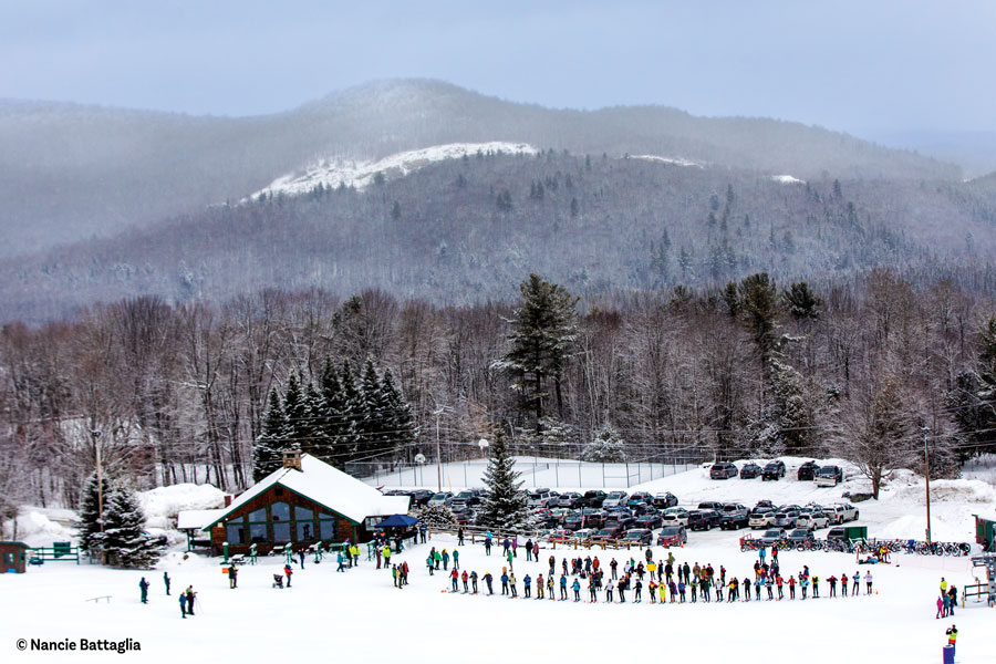
About 8,000 people signed in at canoe area trail registers in 2008, the last year for which DEC figures are available. Nearly half of them were there to climb St. Regis Mountain, at 2,874 feet the highest Adirondack summit northwest of the High Peaks. Most hikers drive to the trailhead, off Keese Mills Road in Paul Smiths, but there is a water-access trailhead on Upper St. Regis Lake. Spring and fall often attract trout fishermen (in the Blagden lean-to logbook a party of six recorded catching 26 brook trout, three lake trout and one splake that May), and winter brings cross-country skiers, especially to the 4.7-mile truck trail to Fish Pond, which needs only a few inches of snow for gliding. The truck trail is open to mountain biking the rest of the year.
Middleton has been to every body of water larger than a swimming pool in the canoe area. “But there are always places you can go that you’ve never been, even after 20 years,” he said.
For me, one of those places was still Ledge Pond. Paddlers tend not to be pond-baggers. The High Peaks Wilderness Area inspires a self-selecting group who summit its 46 highest mountains; there’s no equivalent for the canoe area. But the fact that Ledge Pond was so close (1.25 miles from the put-in) yet so elusive gave it trophy status in my mind.
On an October afternoon with a half-moon and geese overhead, the water was high enough for passage upstream. My husband and I got out of the boat and started up a scant trail. He angled and squeaked the canoe sideways through a tight stand of young conifers. The trail dissipated on a hardwood knoll, the other side of which was a well-beaten path along a stream. We followed it to a break in the trees—a portal to a hushed, golden bowl of light.
Mark tied on a streamer fly and fished beneath a cliff, the pond’s namesake, by the northeast inlet. We floated until last rays. Tracing the more-obvious trail near the outlet on the way out, we got back in the boat, paddled in twilight down to Pink Pond, then Long Pond, where the take-out waited in inky black woods against a fading green sky.
IF YOU GO
State Route 30 is the main road to the St. Regis Canoe Area, west of Saranac Lake and northeast of Tupper Lake. Off Route 30 the DEC’s Fish Hatchery Road, near Lake Clear, has two put-ins, and Floodwood Road, near Saranac Inn, has three parking areas near canoe access points. Floodwood is also a launching place for ponds in the Saranac Lakes Wild Forest to the south. Canoe area itineraries can be extended into this region, and a “Quiet Waters” campaign is advocating making 13 of the wild forest’s ponds off-limits to gas-powered motorboats and Jet-Skis.
Several maps and guidebooks offer canoe area information. Though dated, a reliable source is Paul Jamieson and Don Morris’s Adirondack Canoe Waters: North Flow (1994). Adirondack Paddler’s Guide: Finding Your Way by Canoe and Kayak in the Adirondack Park (2008) by Paddlesports Press is more recent. The canoe area is covered by the St. Regis Mountain and Upper Saranac Lake USGS topographic maps as well as by the 2008 Paddlesports Press “Adirondack Paddlers’ Map” and the “Adirondack Canoe Map” (1987, Plinth, Quoin & Cornice Associates). However, no map is entirely accurate; trails and campsites have been moved or mismarked, so be prepared to change plans accordingly.
The DEC Unit Management Plan for the canoe area contains lots of information on usage and natural history.
Signature routes include the Seven Carries, originally a way to travel between Prospect House on Upper Saranac Lake and Paul Smith’s Hotel, on Lower St. Regis Lake. Today it’s a popular day-trip or overnight; pond and put-in options vary—there aren’t always seven carries, but the name endures.
The Nine Carries can start on Little Clear Pond, Hoel Pond or Upper St. Regis Lake and follow a variety of pond-hop itineraries ranging from 13 to 18 miles (including 1.5 to 2.5 miles of carries). Consult maps and guidebooks to design your own route. (See “Paths of the Paddlers,” April 1991.)
A hike up Long Pond Mountain (about 1.5 miles, 900 feet ascent) adds variety to outings in the Long Pond–to–Hoel Pond area. The trail is gorgeous, rerouted 10 years ago by the DEC; the take-out on a northern lobe of Long Pond is well marked and also leads to Mountain Pond.
St. Regis Mountain’s 3.4-mile trail is north of most of the ponds, but its unbroken views of the waters below attract nearly as much traffic as the rest of the canoe area combined. The Adirondack Park Agency voted in April 2010 to preserve a 1918 fire tower at the summit.
Nearby outfitters offer boats and gear for rental or purchase as well as guided trips:
St. Regis Canoe Outfitters (518- 891-8040, www.canoeoutfitters.com), on Floodwood Road at the Long Pond portage, with its couch and woodstove, is as much woodland lounge as shop.
Mac’s Canoe Livery (518-891-1176, www.macscanoe.com), at the edge of the canoe area, 5859 State Route 30, in Lake Clear, is close to the Fish Hatchery Road put-ins.
Adirondack Lakes and Trails Outfitters (518-891-7450, www.adirondackoutfitters.com), at 541 Lake Flower Avenue, in Saranac Lake.
Raquette River Outfitters (518-359-3228, www.raquetteriveroutfitters.com), on Route 30, in Tupper Lake.


