Snow-covered terrain is a layer cake of frost and creatures. Last winter, particularly cold and snowy, the white frosting rose almost three feet atop the Tongue Mountain Range along Lake George. The mice and voles lived beneath the flakes, at ground level. Another four feet of earthy frost below that, in crannies and caves, Tongue’s rattlesnakes denned. They could not get at the rodents, nor to us; they were torpid, hibernating, unable to twist along.
The mice and voles were scurrying about, making ends meet in that narrow, ice-ceilinged air pocket called the subnivean zone. Winter predators like fox, weasel or owl had to listen hard and pinpoint their pounces to make a catch. Unwittingly, we sometimes whomped that snowy roof in as we climbed and glided along the ridge.
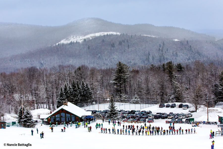
This was a mid-February trek for five of us—four on skis, one on snowshoes. Photographer Carl busted trail on the steep ascents, and we clambered up after him. We four careened the descents, and he sashayed on down behind. My wife, Betsey, our friends Scott and Marcy, and I came south from Keene Valley to traverse this wild and woolly Lake George ridgetop. Scott, a formidable skier, yet novice to these southerly wilds, was skeptical there could be any respectable terrain outside of his High Peaks. He was in for a more than pleasing surprise.
Tongue Mountain is what it sounds like: the long, hefty coach whip of a peninsula that sticks into the Adirondacks’ largest interior lake. The range has five summits, but our ride would cover only half its length. Picture a roller coaster moving out of its starting gate briefly level and making a long, gradual climb of three miles to its high point. The track levels off again at the top of the 2,256-foot mountain, takes a couple of warning bumps in a rolling exploration of small summit knobs, then dashes into action with an 800-foot drop, hits a right intersection and swoops down another 1,100 feet, ending 700 feet below where it started. The last bit is a slight uphill, wringing out all the gasping momentum.
The snow was deep and the air cold; the winter of 2014 was an anomaly in these years of climate change, which has started to curtail all things wintry in the Adirondacks. We were lucky to have this day. It was about 10 degrees at our 10 a.m. start from the high point of Route 9N’s passage “over the Tongue” at the north end of the range. A slight warm-up was forecast for the deep blue, sunny day. We waxed green and bundled up, awaiting our own warm-ups. The outset was wide and smooth, on a woods road—almost a boulevard. It gently climbed and wound about to skirt a beaver wetland on a plateau, and the roadway faded to trail with the first steep uphill at the Deer Leap trail intersection, just over half a mile in. We began to peel our layers.
We were on one of the first five Conservation Department ski trails, designated in 1938 for its initial two-and-a-half miles to Tongue Mountain Camp lean-to. It must have been cut wider than its present hiking width. Some of the hills are skinny and steep, though open woods every so often lend room to maneuver. Perhaps we should have brought climbing skins, as there were uphill scrambles, but then the seven to 10 little sticky descents would have frustrated.
After the Dear Leap junction, we headed up Brown Mountain under warming sun, in mixed deciduous and pine woods on the southeast side of the ridge. Brown’s summit is the first expansive look southeast of the ridgetop and over the islands down in the lake. The soft bass whooooomph of settling snow was with us all the way along the ridge. On steeper open terrain, this sound would signal an avalanche. Yet along the wooded and blanketed Tongue Range, it was just a soft background vibe—though likely worse than that for the mice and voles.
The Tongue Range is one of the northernmost homes to the eastern timber rattlesnake, which thrives on those small rodents. The rattlers, classified as a threatened species, live under state and federal protection. Warm-weather hikers infrequently cross paths with these unaggressive creatures, but right now they were unbothered in a deep sleep, deep down. It was left to us to twist along the ridge.
Soon came the first dip and then a gradual climb through open, grassy pine meadows. The vistas came more frequently at Tongue Mountain Camp lean-to and beyond; there were peeks toward Gore Mountain to the west and to our hometown High Peaks up north.
The trail did get twisty between small summit nubbins and cols along Five Mile Mountain. From several of the bumps we looked south over the central ridgetops to the broad lake ahead. The steepest shore was across from us and to the east, rising 2,300 feet to Black Mountain, the highest point in the basin.
The Lake George valley was formed several hundred million years ago by faults on both its sides pulling the land apart, with the middle dropping out. (Geologists call this a graben, German for “grave,” the burial hole.) All was later scrubbed and bulldozed by the last glaciers, a hundred or so centuries back. Water gradually filled the basin.
Past Five Mile Mountain the trail’s bottom dipped through south-facing hillsides and chutes, 800 feet down to our second intersection, with the Five Mile Point trail. The descent was not quite relentless; it bent right and left along the contour for quick snippets of R and R. We gaped at occasional views through nearby trees beneath the ledges and toward the frozen lake far below. The forest opened above the junction, and there was room for playful turns before we pulled up for a breather.
Here, you might stay straight ahead on the main roller-coaster route along the ridge, sliding up and down six more miles over Fifth, Third and First Peaks and descend, breathless, to a flat stop on Montcalm Point at the tip of the Tongue. Such a winter trek would be major, surely needing an overnight, unless conditions were perfect on an already-broken trail. That entire gamble of a gambol stretches and bounds 10-and-a-half miles, a wild up-down of over 6,100 vertical feet. And that is only a one-way ticket.
We took a right at the fork to Clay Meadows and almost immediately had to get off the skis, hoofing it. Well below the ridge, the snow depth had shrunk. Heading west, we first alternated between gentle sweeps and steep rough patches under hemlocks. Past two shadowy and rocky steeps, the trail once again took on a smoother, roadlike grade. Carl got some action shots of us swooping past, the background a blur and the shallower snow not an issue. This was a two-mile, 1,100-foot downhill mostly glide to the head of Northwest Bay. Glimpsing the lake, we collected ourselves at our third junction of the day, with the Northwest Bay trail, for the final meander to the car. There was a bridge over Northwest Bay Brook, partly broken by falling pines, but solid enough for us.
The Tongue Mountain Range was the scene of an early conservation battle, with its prime player an avid backcountry skier. John Apperson, of Schenectady, skied Mount Marcy, one of the first to do so, reputedly in 1911. He also loved Lake George and tirelessly guarded its newly public islands, taking on no less than Robert Moses, the self-aggrandizing developer of New York State parks. Moses sorely wanted to build a spectacular 14-mile-long Tongue Mountain shoreline highway. In 1923 Apperson personally lobbied Governor Al Smith against the plan and organized landowners along Tongue to sell or donate their lands to the state for the Forest Preserve. Apperson and his friends won the day, and the highway, Route 9N, runs well back from this shore. Ninety-nine percent of the Tongue Mountain Range is constitutionally protected.
We were down at lake level. The sun was getting low, but still lighting the ridge we’d sailed off. We wound our way up the last small hills, through the pine shadows and to the car. It was a cozy pile-in, what with skis, poles, packs and the five of us, but a scant three miles and 700 feet back up to our starting point, along the roadway that John Apperson had pushed back from the Tongue.
This was not an easy trip, and it covered only the northern half of the range, climbing 1,200 feet and dropping 1,900 feet. The trail was partly tracked out for the first and last two miles. As the fresh snow was soft and deep, our trail-breaking stint was slow work. The seven miles took us seven hours.
We’d climbed through dark evergreen forest, wound about open woods and meadows, rumbled over rocky knobs, swooped fast hills long and short, and gazed down at the lake from near and far. Plenty of terrain here, Scott! Tongue Mountain is big, pristine, wild and protected.
So are its rattlesnakes, returning to their dens after another summer of twisting along. As you read this tale in winter, let’s hope it will be our turn again—and if we can halt escalating climate change, it may be, for many years to come.