New ski routes with old roots around North River
You want to know what life was like in days of yore? You could go to the Adirondack Museum, at Blue Mountain Lake, the perfect place for a rainy summer day.
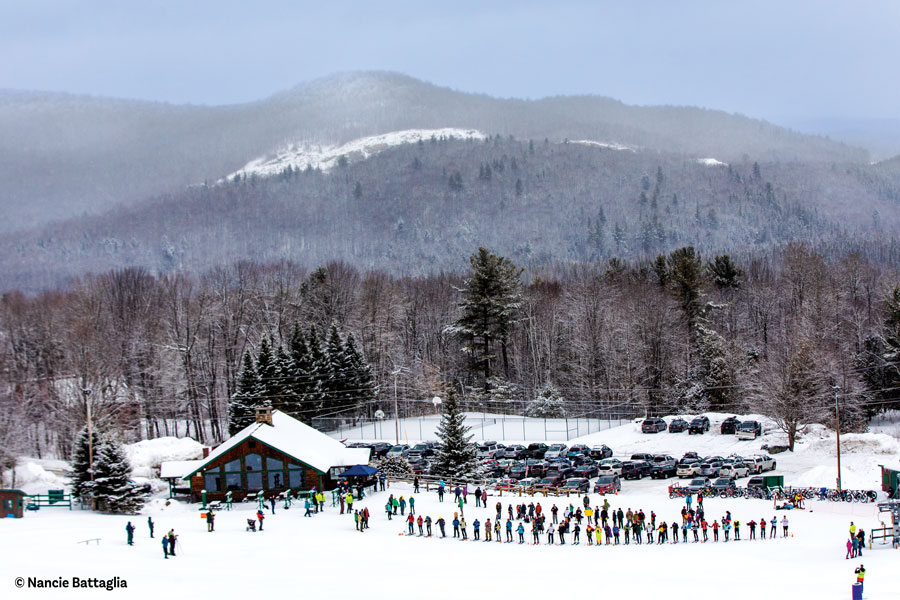
But on a snowy day? Grab your skis and head for the newly built trailhead on Barton Mines Road, in the hamlet of North River. Park, snap into your bindings, climb for about 15 easy minutes to the height of land on Pete Gay Mountain and then head downhill fast. But not just downhill. Backwards in time.
In less than five miles you’ll drop 1,450 feet, till you finally reach the base of North Creek’s Ski Bowl, where chair lifts grind up Gore Mountain. If you make it to the bottom—well, you’ve just descended the Colonial Williamsburg of alpine America, the deep woods of the Raymond Brook Valley that, in the 1930s, were the original American ski slope, home of the “Ride Up–Slide Down” business that helped northern Warren County weather those Depression winters.
In those days the snow trains would leave from Grand Central Station and Schenectady, passengers piling out at the North Creek depot; 50 cents bought you a ride up to the trailhead. And then you skied down, and then you did it again. That’s what skiing was—the 1932 Olympics in Lake Placid didn’t even have downhill events, just cross-country and jumping.
About three miles down the Raymond Brook trail you’ll pass what looks like an old corrugated tin hut on stilts—that’s where they kept the rescue sled, making it just about the oldest ski-patrol structure in the nation.
Pete Gay’s allure didn’t last, of course. After World War II American skiing turned into rope tows and then quad chair lifts and then gondolas, a highly mechanized, clear-cut, groomed-slope, big-money operation. Those old trails grew swiftly in, and the old ways were forgotten. Cross-country skiing evolved into something separate, with its own groomed trails, like the classic loops at nearby Garnet Hill Lodge. But a few people still knew the history and the possibilities Raymond Brook presented.
One of them was Steve Ovitt, who recently retired as the Department of Environmental Conservation (DEC) forest ranger for the district after nearly three decades, carefully resisting all the opportunities for promotion that would have brought him out of the woods and behind a desk. Instead, his knowledge of the local forests just kept deepening, and with it a nagging idea: why not revive those old trails and add some new ones, making the edges of the Siamese Ponds Wilderness back into a skiers’ paradise? He started plotting in the 1990s, and he’s spent the last seven years cutting trails out, mostly with the help of an all-volunteer local crew. Of the 16 miles of new routes, a little more than 12 miles have been set aside for skiing—although two miles of the hiking trails are also appropriate for experienced backcountry skiers. Add to that 13 miles of recovered paths, more than half designated as ski trails, and that’s almost 30 miles, by far the largest network of trails opened anywhere in the Adirondacks in many years. Plus there’s 15 bridges, four new trailheads with parking lots and a camping area for people with disabilities at Thirteenth Lake. “Presidents aren’t the only ones who can leave a legacy,” Ovitt says.
Siamese Ponds Wilderness is very much a wilderness—as high and wild as any place inside the Blue Line, most of its interior untrailed and untraveled. But it’s a characteristic Adirondack wilderness, in that humans have left their mark. In a big way, as it turns out. Just ask Queensbury’s James Underwood; he’s a leader of the Siamese Pond Trail Improvement Society, the volunteers who, under Ovitt’s supervision, have hacked back decades of deadfall and windthrow.
Underwood has also cleared the underbrush from the region’s history. The main trunk route in the Siamese Ponds, from Bakers Mills across the shoulder of Eleventh Mountain and through to Old Farm Clearing, follows the ancient stagecoach road north along the Sacandaga River. But that early touch was pretty light; it was the wholesale logging of the late-19th century that marked the high point of human intervention. Underwood found a New York Times account from the fall of 1889 that follows the Sacandaga from Wells all the way to its source at Botheration Pond and described the scene like this: “There stands not one hemlock tree or spruce or pine that is more than five inches in diameter. The lumbermen have done their work of devastation in the most thorough manner.… Even the mountain streams are as dry as Broadway is of a hot Summer’s day.… It is a sad thing to contemplate. There is as much pathos in a ruined forest as there is in a burned settlement.”
And as much hope, therefore, in a forest restored. One of Ovitt’s trails is an eight-mile loop around that selfsame Botheration Pond. It’s relatively easy—“beginner to intermediate skier, anyone who can put the brakes on if they get in a little trouble,” says Underwood. But you might as well be in Alaska—this is deep woods now, lonely and big, with moose sign and hemlock bank. (One elderly couple found just how lonely last winter, when they were benighted on the trail; Ovitt led them out about 9:00 p.m.) You climb from Old Farm Clearing and then kick and glide easily for miles, with only the narrow opening of the trail through the woods to remind you you’re not the first to pass.
Until you come to the bridges, when it’s remarkably clear someone has been here before. By bridges, I don’t mean a few logs felled across the East Branch of the Sacandaga. I mean rustic engineering projects of a kind that would have charmed Great Camp builder William West Durant. There’s a 36-foot spa—“the only hardwood-veneer-quality cherry bridge in the Adirondacks,” according to Ovitt—which is impressive enough, but a little farther on you reach the North Country equivalent of the Golden Gate, a 50-foot clear-span bridge crafted entirely by hand. “It took two weeks to build it,” says Ovitt, “and about a hundred dollars in materials.” It should last half a century.
If the trail is unobtrusive, it’s far from unplanned. Ovitt and his crew of volunteers are all avid skiers, and so these are not just hiking paths covered with snow. “You have to think about skiing all the time you’re cutting them,” Ovitt explains. “You need to be on the south side of an east-west valley so it’s in the shade. That’s the key, no sun on the trail. So there’s no melting and then no crust when it refreezes. If it’s on the other side the snow gets sticky, and then it gets missing.”
Ski trails are happier in the hardwoods too, where bare branches don’t block the falling flakes. “Even in a softwood stand you have to search for the few hardwoods and route the trail there, so there’s an opening for the snow to get through,” he says.
Most of all, though, you have to envision the turns. “It’s looking at the hill and imagining what it will be like in the snow,” he says. “Here’s the radius of the turn, here’s your recovery into the next turn. You want to keep speed down and pleasure up. It’s OK to have a small thrill, you just don’t want your life flashing in front of your eyes.”
That’s why the Raymond Brook downhill tracks to North Creek are so amazing—there’s really nothing like them in the rest of the park. They’re not the experts-only parachute drop from the top of Marcy, but they’re not for idle nice-day-in-the-woods skiers either. Don’t go on the skinny skis you’d use at Mount Van Hoevenberg or Lapland Lake; you need metal-edged backcountry skis and a boot stiff enough to let you turn. Because—well, because there are trees. To watch Underwood telemark through the glades on the steepest drops is to see the definition of control, powder rooster-tailing up on either side. “It’s like an intermediate trail at a downhill ski resort,” he says—and indeed at one point we can hear the lifts at nearby Gore. “Hey, for $80 you could be doing that too,” he adds with a smile.
After the steepest drops the trail mellows; for several miles you just stand happily in the tracks, gravity pulling you down at a decent clip past huge yellow birches and towering maples. As you near North Creek, you have your choice. Most people ski out on an easy grade to the Ski Bowl, emerging not far from the nursing home at its northern end. But if the snow is deep and you’re feeling bold, there’s a three-quarter-mile drop to a new parking lot on Route 28 directly across from the Hudson River. It’s the hardest part of the trip—on the old ski maps from the ’30s, one of the two ancestral trails is named Fool Hardy and the other the Hardy Fool. Either way it’s full speed back to the car. At which point, there’s really only one thing to do.
“It’s a full-circle thing,” says Underwood, as we pile into his Subaru for a trip back up Barton Mines Road. “You started out with the drive up–ski down system, and now we’re back to it. Once you do it, you think: that’s all we really needed.”
INTO THE WILD
Learn about trails, lean-tos, ponds and peaks in the 114,000-acre roadless Siamese Ponds Wilderness Area at www.dec.ny.gov/lands/22596.html. Garnet Hill Lodge posts conditions for its trails, which are adjacent to Siamese Ponds Wilderness, at www.garnet-hill.com/weather.html.
Raymond Brook Trail
This venerable downhill trail is a superb deep-snow adventure. You’ll need backcountry skis with metal edges, stiff boots and poles with big baskets—and an arsenal of turns and stops.
Trailheads: Barton Mines Road, off Route 28; parking area on Route 28 near intersection with Barton Mines Road; North Creek Ski Bowl Distance: 3.6 miles from Barton Mines Road to Route 28 parking area; 4.2 miles from Barton Mines Road to Ski Bowl. This is a one-way, two-car trip.
Difficulty: Intermediate to advanced
Time: At least two hours
Botheration Pond Loop
Hills, curves, handsome woods, icy cliffs, remote waters and beautiful rustic bridges are just a few of the pleasures of this exceptional loop route.
Trailhead: Old Farm Road, Thirteenth Lake Road, off Route 28, North River
Distance: Eight miles
Difficulty: Intermediate
Time: Half- to full-day trip, depending on conditions
Second Pond Trail
Trailhead: Top of Chatiemac Road, off Route 8 near Bakers Mills
Distance: Six miles, out and back
Difficulty: Intermediate to advanced hilly terrain; there may be blowdown from Tropical Storm Irene.
Time: At least three hours
A version of this article originally appeared in the December 2011 issue of Adirondack Life. Subscribe now to receive eight issues per year.


